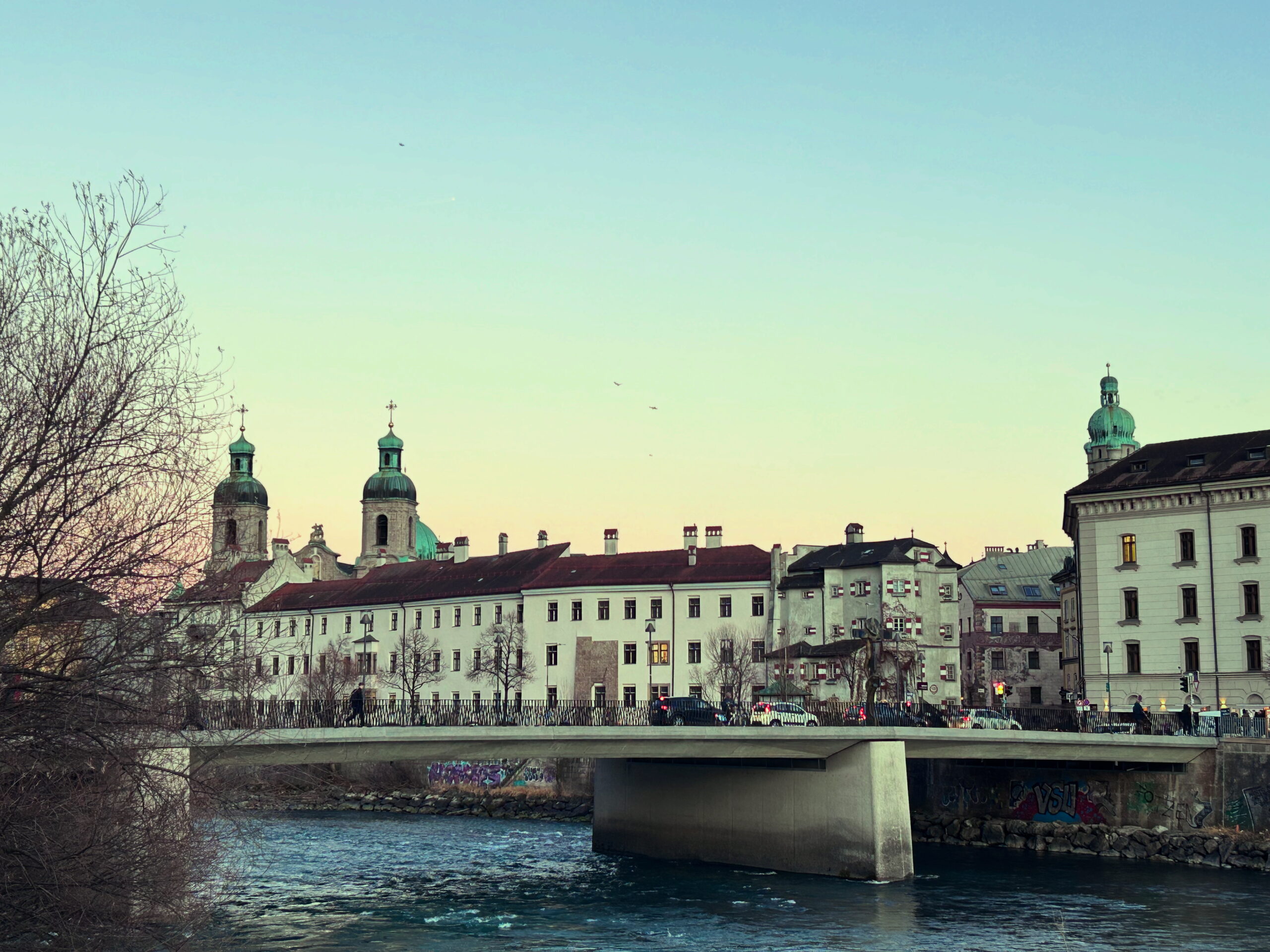
Inn bridge
Opposite Innstraße 5 / Innrain 1
Worth knowing
Man könnte sagen, die Innbrücke war die Geburtshelferin Innsbrucks. Bereits das erste noch erhaltene Stadtwappen aus dem Jahr 1267 zeigt sie auf den damals zur Sicherung verwendeten Steinkästen. Sie war Namensgeber für die Stadt und für Jahrhunderte die einzige Brücke, die die heutige Altstadt mit den älteren Stadtteilen St. Nikolaus und Mariahilf verband. Vor allem aber war sie die Quelle des Aufschwunges und Wohlstandes der Stadt. Die Grafen von Andechs erkannten die Bedeutung des Knotenpunkts zwischen Nord und Süd im Warenverkehr. Bis dahin war die einzige Brücke über den Inn in dieser Gegend ein Überbleibsel aus der Antike beim römischen Militärlager Teriolis, dem heutigen Martinsbühel bei Zirl. Im 12. Jahrhundert ließen sie eine Brücke über den Inn bauen und sie mit einer Befestigungsanlage sichern. Wie einige Jahrhunderte später Panama- und Suezkanal brachte die Verkehrserleichterung Vorteile für den Fernhandel und Gewinn für den Betreiber der Anlage. Wer über den Seefelder Sattel oder durchs Inntal kam und nach Süden über den Brenner weiterreiste, war dank der Innbrücke wesentlich schneller. Das hatte seinen Preis. Neben den Steuern war der Zoll die wichtigste Einnahmequelle Innsbrucks. In Zeiten, in denen es keine nationalen Landesgrenzen im heutigen sehr engen Sinn gab, waren Zollgrenzen auch hochpolitisch. Es gab keine Schlagbäume oder Grenzbeamten an der Tiroler Landesgrenze, spürbar wurde der Übertritt von einem Herrschaftsbereich in den anderen durch die abzuliefernden Abgaben. Der Zoll war ein Steuerungswerkzeug der Landesfürsten. Während heutzutage Zentralbanken Leitzinsen verändern, hatten Regenten nach Naturkatastrophen, Seuchen, Bränden oder Kriegen Zölle und Abgaben zur Verfügung, um Handel, Konsum und Wirtschaft oder die Staatseinnahmen anzukurbeln. Der Zoll wurde am Stadttor an der Innbrücke erhoben. Es gab zwei Arten von Zöllen. Der kleine Zoll richtete sich nach den Zugtieren des Wagens, der große nach Art und Menge der Waren. Die Zolleinnahmen wurden zwischen Innsbruck und Hall geteilt. Hall hatte dafür die Aufgabe, die Innbrücke in Stand zu halten. Der Handel füllte nicht nur die Stadtkassen, die Bürger genossen auch das Niederlagsrecht. Waren, die ansonsten im Alpenraum nur schwer verfügbar waren, mussten zum Verkauf in der Stadt von den durchkommenden Händlern zum Verkauf angeboten werden und waren damit für alle verfügbar, die über genügend Geld verfügten. Wein, Bier, Fleisch, Salz, Gewürze, Textilien – Innsbruck hob sich dank des Warenverkehrs über die Innbrücke in vielen Lebensaspekten wie Mode, Essen und Trinken vom Umland ab.
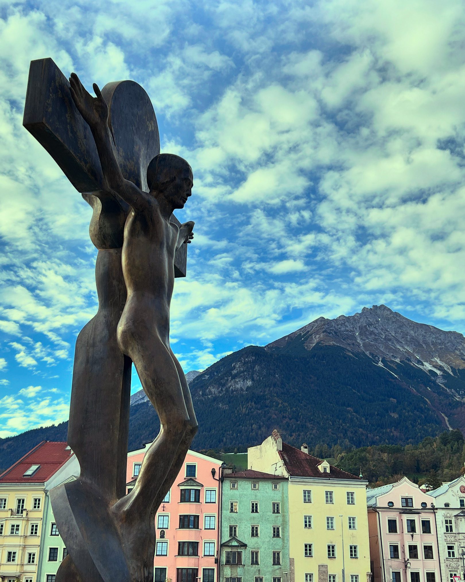
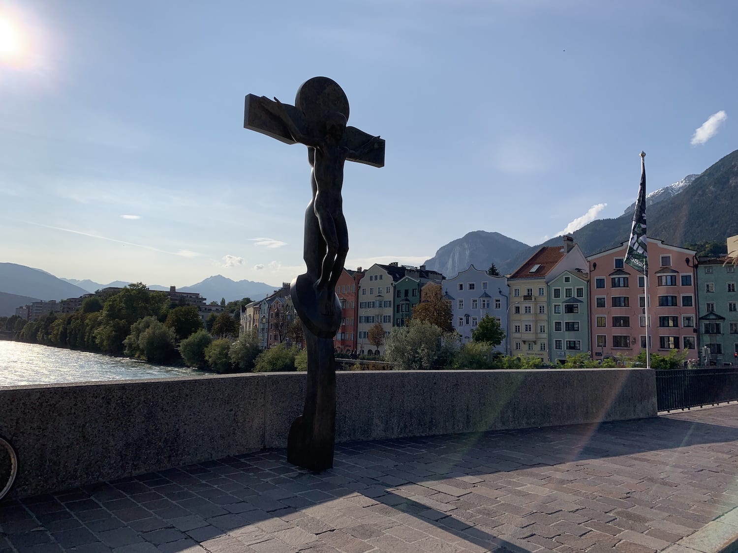
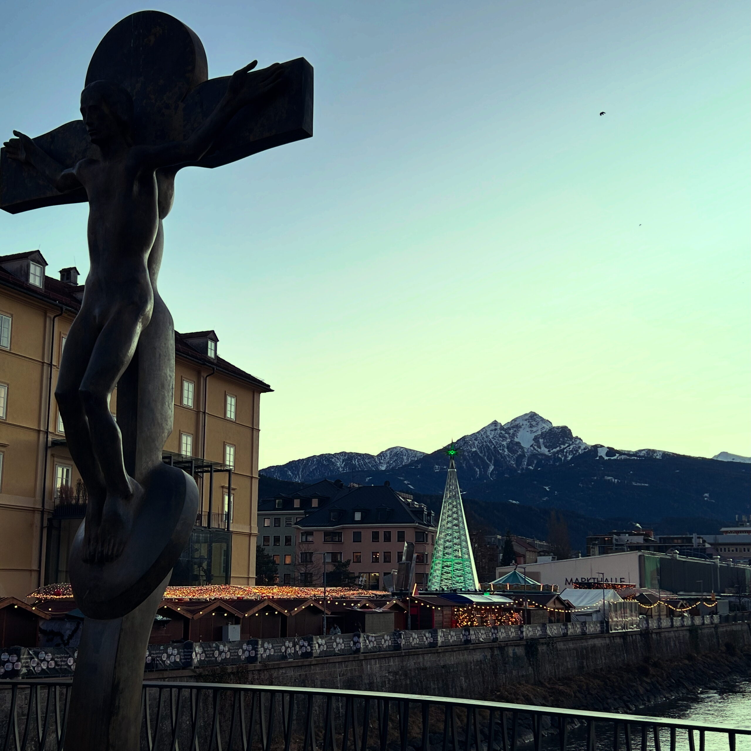
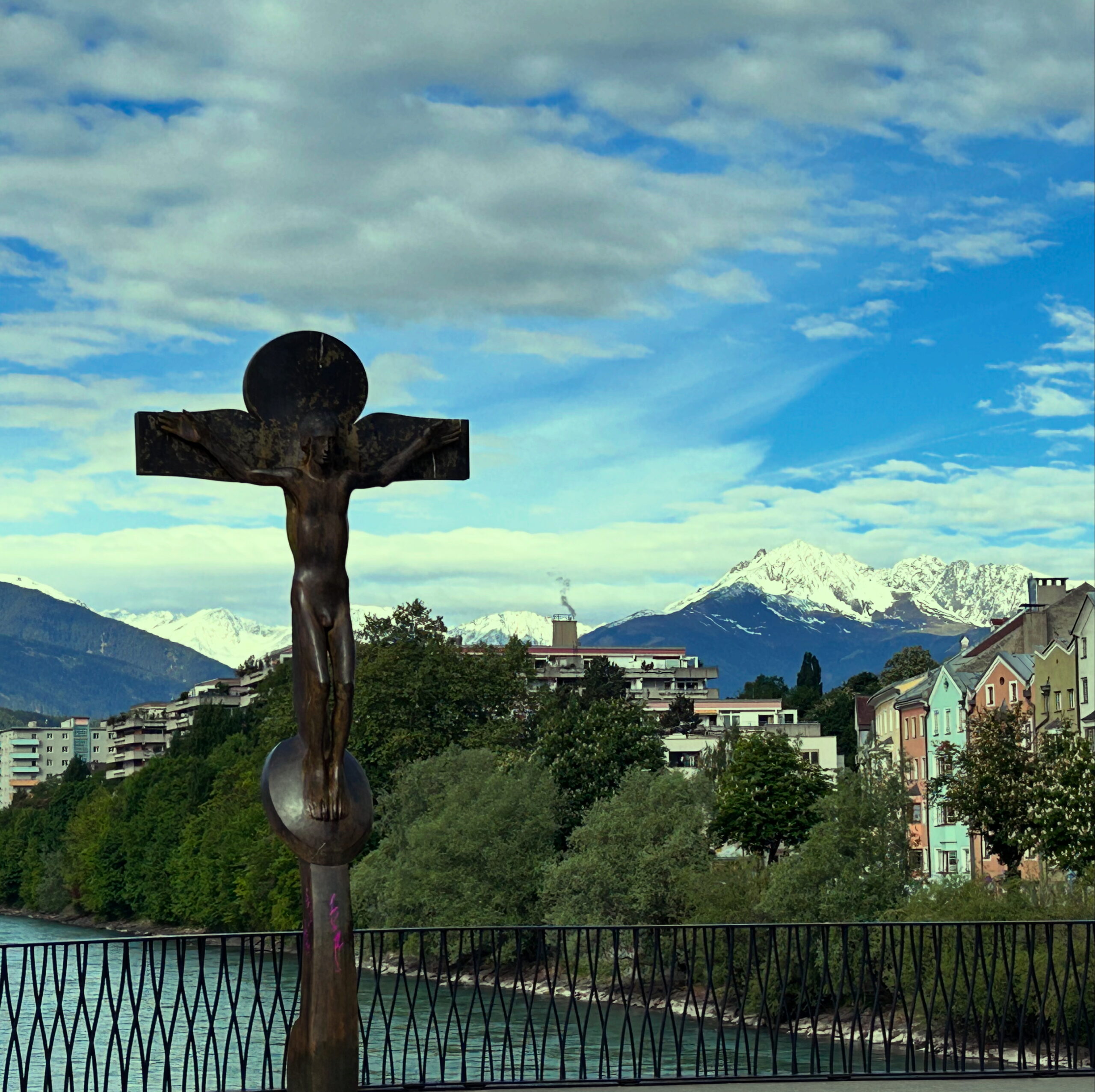
The Inn Bridge lost its exclusive importance as a trade route when the Mühlau Bridge opened in the 17th century. With the arrival of the railway, the transport of goods through the city center decreased further. In the 19th century, however, individual traffic increased. Apart from river rafts, the Inn Bridge remained the only near‑city crossing between the two banks of the dividing river for a long time. When the bridge was closed—often due to flood damage—the districts were effectively separated. In the Age of Enlightenment, it became intolerable that nature could so strongly disrupt everyday life. During the 18th‑century regulation of the Inn within city limits, the Inn Bridge was modernized, yet its wooden construction repeatedly fell victim to flooding. A first stone bridge, built in 1790 from remnants of the old city gate, could not withstand the pressure on the river’s soft bed. Bold plans to construct a suspension bridge failed due to lack of space at the Old Town entrance. In 1871, after another flood destroyed the wooden bridge, it was replaced by an 83‑meter iron truss bridge supported by only two concrete pillars. In 1983, the Inn Bridge was rebuilt in its present form: concrete spans supported by reinforced‑concrete pillars. The retaining walls were—true to Innsbruck’s building tradition—constructed from highly durable Hötting breccia. The latest renovation, including widening and replacement of the railing, took place in 2023. A special gem of Innsbruck’s cultural history can be found in the middle of the bridge: the crucifix by Thaur artist Rudi Wach (1934–), depicting Christ naked and without wounds in a strikingly human manner. Planned for installation in 1986, the sculpture had to remain in the Tyrolean Folk Art Museum for over two decades due to a petition campaign led by particularly devout Tyroleans. Only in 2007 was it finally erected—officially as a gesture of thanks to the heavens for sparing the city during the 2005 flood—by Innsbruck’s first female mayor, Hilde Zach.
The Counts of Andechs and the foundation of Innsbruck
The 12th century brought economic, scientific, and social growth to Europe and is regarded as a kind of early medieval Renaissance. Through the indirect route of the Crusades, intensified exchange took place with the cultures of the Near East, which were more highly developed in many respects. Via southern Spain and Italy, Arab scholars brought translations of Greek thinkers such as Aristotle to Europe. Roman law was rediscovered at the first universities south of the Alps. New agricultural knowledge, technical innovations, and a favourable climate—which was to last until the mid‑14th century—enabled the emergence of towns and larger settlements. One of these settlements lay between the Roman road over the Brenner Pass, the River Inn, and the Nordkette mountain range. Politically and economically, the importance of the Inn Valley was largely limited to transit. The two relatively low and therefore easily passable Alpine crossings—the Reschen Pass and the Brenner Pass—between the German lands and the possessions of the German kings in Italy converged in the wide valley basin. A dispute over control of this part of the Holy Roman Empire gave rise to the political constellation that would shape Tyrol and Innsbruck well into the modern era. In 1024, Conrad II of the Salian dynasty was elected king. He found himself in competition with the Bavarian dukes of the House of Wittelsbach, under whose control the coveted Alpine passes lay at the time. In order to wrest the territory away from his Bavarian rivals and place it under the control of the Reich Church loyal to him, Conrad II granted the territory of Tyrol as a fief in 1027 to the bishops of Brixen and Trento. The bishops, in turn, required so‑called Vögte (advocates) to administer these lands and exercise jurisdiction. These advocates of the Bishop of Brixen were the Counts of Andechs. Although today the Andechs family stands in the shadow of the Welfs, Hohenstaufen, Wittelsbachs, and Habsburgs, they were a powerful dynasty in the High Middle Ages. They originated from the region around Lake Ammersee in Bavaria and owned estates in Upper Bavaria between the Lech and Isar rivers as well as east of Munich. Through skilful marriage policies, they acquired the titles of Dukes of Merania—a region on the Dalmatian coast—and Margraves of Istria, thereby rising in rank within the Holy Roman Empire. To secure both administration and eventual salvation, they founded Dießen Abbey and the monastery on the Holy Mountain of Andechs above Lake Ammersee in the 12th century. In 1165, Otto V of Andechs ascended to the episcopal seat of Brixen and granted the advocacy over this prince‑bishopric to his brother. In this way, the Andechs family gained control over the administration of the central Inn Valley, the Wipp Valley, the Puster Valley, and the Eisack Valley.
But this was far from the end of the dynastic entanglements and political complications that stood in the way of Innsbruck’s founding. Today, the city stretches across both sides of the River Inn. In the 12th century, however, this area was under the influence of two different landlords. Much of the Inn Valley was densely forested, and the banks of the broad river consisted of marshy terrain. South of the Inn, manorial authority was exercised by Wilten Abbey, while the land north of the river was administered by the Counts of Andechs. Whereas the southern part of the later city around the abbey had been used for agriculture for centuries, the floodplain around the unregulated river remained largely unsettled before the High Middle Ages. The region was not one of the hotspots of Europe’s cultural landscape. Most people worked in agriculture under their landlord’s control. They lived in poor huts made of clay and wood. Medical care was almost non‑existent, child mortality was high, and few people lived beyond the age of fifty.
As every good property developer is keen to point out even today, location already mattered greatly when it came to the potential of a new construction project. Around the year 1133, the Counts of Andechs founded the market settlement of Anbruggen in what is now St. Nikolaus, taking advantage of the site’s excellent transport connections, and linked the northern and southern banks of the Inn with a bridge. What had been agriculturally unusable land at the foot of the Nordkette was transformed into a trading hub by this transport link. The small wooden bridge facilitated the movement of goods across the Eastern Alps between Italian and German trading cities. The Brenner route, long considered too steep for large trading convoys, became more attractive thanks to one of the innovations of the medieval Renaissance: new harness systems made it possible for wagons to negotiate steep inclines. The shorter Via Raetia replaced the Via Claudia Augusta over the Reschen Pass as the main Alpine transit route. The farsighted Andechs market benefited from this development. Toll revenues generated by trade between German and Italian cities allowed the settlement to prosper. Soon blacksmiths, innkeepers, wagon operators, tailors, carpenters, rope makers, wheelwrights, and tanners settled there. Horses, merchants, and their retinues had to be fed and accommodated, wagons repaired. Larger enterprises employed workers and servants. What had once been a remote, swampy wasteland became a service centre. The transformation from a purely agrarian area into a town could begin. Anbruggen grew rapidly, but space between the Nordkette and the Inn was limited. In 1180, Berchtold V of Andechs acquired a parcel of land on the southern side of the Inn from Wilten Abbey to expand his trading post. The abbot was unwilling to relinquish his foothold entirely, as the new settlement was flourishing thanks to toll revenues. The deed mentions three houses within the new settlement that were reserved for Wilten Abbey. As part of the construction of the city walls, the Counts of Andechs built Andechs Castle and moved their ancestral seat from Merano to Innsbruck. At some point between 1187 and 1204, the citizens of Innsbruck were granted town privileges. The year 1239 is often cited as the official founding date, when the last count of the Andechs dynasty, Otto VIII, formally confirmed the town charter in a document. At this time, Innsbruck was already the minting site of the Andechs family and would likely have become the capital of their principality. However, events took a different turn. In 1246, the Bavarian Wittelsbachs—the Andechs’ greatest rivals in southern Germany—destroyed their ancestral castle on Lake Ammersee. Otto, the last count of the House of Andechs‑Merania, died in 1248 without heirs. Twelve years earlier, he had married Elisabeth, the daughter of Count Albert VIII of Tyrol. This noble family, whose ancestral seat lay in Merano, thus inherited the fiefs and parts of the Andechs possessions, including the city on the Inn—along with the longstanding enmity with the Bavarian Wittelsbachs.
The power of geography
What most visitors to Innsbruck notice first are the mountains, which seem to encircle the city. The mountain landscape is not only beautiful to behold, but has always influenced many aspects of life in the city. This begins with seemingly minor things such as the weather, as the perspective of the theologian, writer, and politician Beda Weber from earlier times demonstrates:
"“A phenomenon of its own is the warm wind, or Scirocco. It comes from the south, strikes the northern mountains, and then plunges violently into the valley. It often causes headaches, but quickly melts the winter snow masses and greatly promotes fertility. This makes the cultivation of maize possible in Innsbruck.”"
This weather phenomenon may have changed its name from Scirocco to Föhn, and traffic was not yet a major problem in 1851. Yet just as Innsbruck’s motorists complain today, the horseshoer in the old town in 1450 and the legionary dispatched from central Italy to the Alps in the year 350 certainly lamented the warm downslope wind that seems to drive everyone mad several times a month. While people in the past were grateful for the warm air that melted snow on the fields, today tourism officials complain about snow-free ski slopes on the Seegrube.
The location between the Wipptal Valley in the south and the Nordkette range influences not only the frequency of migraines, but also the leisure activities of Innsbruck’s residents, as Weber also observed. “The inhabitants are distinguished by their sociability and benevolence; they particularly enjoy excursions into the countryside during the fine season.” One may debate the sociability and benevolence of Innsbruck’s residents, but countryside outings in the form of hiking, ski touring, or cycling remain very popular today. No wonder—Innsbruck is surrounded by mountains. Within minutes, one can be standing in the middle of a forest from almost anywhere in the city. Young people from across Europe spend at least part of their studies at the University of Innsbruck, not only because of its excellent professors and facilities, but also to enjoy their free time on ski slopes, mountain bike trails, and hiking paths without having to forgo urban flair. This is both a blessing and a curse. The university, as a major employer and educational institution, boosts the economy, while at the same time the influx of students from elsewhere drives up the cost of living in a city that, hemmed in by mountains, cannot expand further.
What today may be perceived as a limitation to spatial growth was once a reason for growth. Innsbruck was fortunate to have access to fresh drinking water thanks to the nearby mountains. In the 15th century, the Nordkette was tapped to supply the city with drinking water. In 1485, the city council had a pipeline laid from a spring in Gramart, near today’s Katzenbründlweg east of Hungerburg, into the city. Using larch-wood pipes up to four meters long, clean water was conducted down into the valley floor. At the Inn Bridge, the pipeline branched left and right toward Mariahilf and St. Nikolaus, and across the Inn into the old town and the Neustadt. Until this small technical masterpiece was constructed, Innsbruck—like other cities—had relied on groundwater from wells. This water was often stagnant and full of pathogens. Beer and wine were not considered safer everyday beverages than water without reason. While the plague could not be kept at bay permanently, typhus and cholera were less widespread than in other cities. Not only because of its drinking water did Innsbruck rise in the 15th century from a small trading outpost to the residence city of the Tyrolean sovereigns. The Brenner Pass is very low and allows the Alpine belt winding along Italy’s northern border to be crossed relatively easily. In times before railways transported goods and people effortlessly from A to B, crossing the Alps was hard labor, and the Brenner was a welcome relief. Between 1239 and 1303, Innsbruck was the only city between “Mellach and Ziller” in the central Inn Valley to hold the princely staple right. Within the regulated carting system, goods had to be transferred from one wagon to another here—an enormous advantage for Innsbruck’s economy. Innsbruck was not as wealthy as Bolzano and had no political significance until the early 15th century, but it became one of the most important transport and trading hubs in the Alpine region. The former provincial capital Merano had no long-term chance against the city on the Inn between the Brenner, Scharnitz, and Achen passes due to its isolation. The Alpine location also favored tourism, which gained a foothold by the 1860s at the latest. Travelers appreciated the combination of easy accessibility, urban infrastructure, and alpine flair. With the opening up of the mountainous region by rail, visitors could travel comfortably, spend their leisure time in the mountains or in one of the spa resorts, and still enjoy the comforts of city life. Once tamed by the rails, the Alps had transformed from a source of problems into an economic asset. The era shaped by difficult agricultural conditions was over; yesterday’s enemy had become a savior.
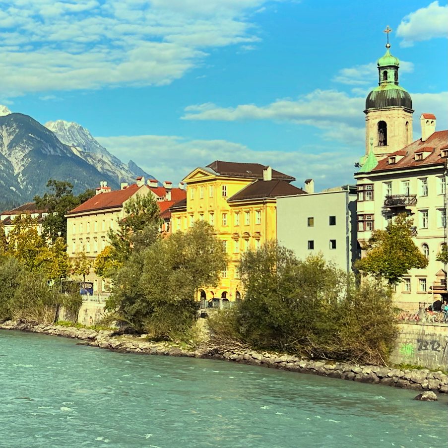
Alongside the mountains, rivers and springs played a crucial role in Innsbruck’s development. Although the city’s drinking water came from the Nordkette via a pipeline, the Inn and the Sill were responsible for sanitation. Livestock were led to the Inn to drink, laundry was washed there, and all kinds of waste—including human and animal excrement—were disposed of in the river. As the city began to grow during industrialization, a first landfill was created at the Sillspitz in the east of the city, later supplemented by another in the west at today’s Sieglanger. More than a thousand years after Roman settlement, the Inn Valley was still a marshy landscape crisscrossed by riparian forests. Settlements such as Wilten, castles like the fortress above Amras, and roads were built some distance from the river on alluvial fans or at mid-altitude elevations. Around Innsbruck, the floodplains were used as communal land by the villages. Depending on the water level, pastureland and firewood were available, and the river could—or could not—be used as a transport route. Field names such as Am Gießen in the Hötting floodplain still recall the fact that the Inn, within today’s city limits, remained an untamed and only poorly cultivated wilderness until the early modern period. Flooding was a recurring consequence of the unregulated river. Between 1749 and 1789, several floods in Innsbruck claimed many lives, and the economic damage was immense. The Inn Bridge brought customs revenues into the city treasury and was the reason the settlement could develop into a city.
Until the road network was improved in the 16th century, heavy river traffic prevailed between Telfs, Innsbruck, and Hall. The rafts used to transport goods were flat platforms measuring up to 35 by 10 meters. Several of these vessels formed a convoy that carried all kinds of goods down the Inn to its confluence with the Danube in Passau and onward to the east. Silver, building materials, timber, salt, wheat, meat—the upstream-bound convoys, hauled by horses along towpaths beside the riverbed, were the fastest way to transport large quantities of goods through the Inn Valley. The military also used the Inn for logistical support. For centuries, timber from the Upper Tyrol was floated downstream as log drives. In Hall, a timber rake at the Inn Bridge caught the valuable driftwood. Innsbruck, and especially the salt and silver mines in Hall and Schwaz, depended on this material and energy source. Near settlements and cities, fortified river engineering structures were built to tame the river at least somewhat and reduce the effects of flooding and drought. In the 18th century, the economization and scientification that affected all areas of life also promoted the cultivation of the landscape. Inspired by the spirit of the Enlightenment, efforts were undertaken to optimize the Inn as a transport route and increase the productivity of available land. The communal lands along the Inn were increasingly placed under the stewardship of individual landowners who advanced the reclamation of this alluvial terrain. The Theresian state apparatus sought to connect the vast Habsburg Empire not only by roads, but also via its major rivers. Responsibility for regulating and engineering the Inn shifted from the municipalities and the Hall saltworks to the state. Innsbruck’s first chief river engineer, Franz Anton Rangger, began mapping the Inn in 1739 in order to make the river course more predictable and faster through straightening and construction works. The project of taming the river would take more than 100 years. The Napoleonic Wars delayed construction, and only after the economic hardship of the early 19th century was the state able to continue the project. Stone block dikes gradually replaced the earlier wooden structures. By the time the Inn was finally tamed, railways had replaced river shipping as the main transport route. The next major phase of river engineering came in the second half of the 20th century. The Olympic Village, the motorway, and settlements such as Sieglanger required space that had previously been reserved for the river in order to enable the postwar economic miracle.
Almost as important as the Inn was the smaller river that runs through Innsbruck. Where the Sill emerges from the Sill Gorge today, the Sill Canal originated, supplying the city with water. When the Counts of Andechs founded their market at the Inn Bridge in 1180, the canal already existed, as the mill of Wilten Abbey in St. Bartlmä was already in operation. From there, it ran along what are now Karmelitergasse, Adamgasse, Salurnerstraße, Meinhardstraße, Sillgasse, and Ingenieur-Etzel-Straße to the Pradl Bridge, where it rejoined the Sill before flowing into the Inn. During construction work, sections of this walled channel are repeatedly uncovered. Initially intended primarily for fire protection, many businesses soon made use of the water flowing through this artificial canal for energy generation. The last remnants disappeared in the 1970s after bomb damage during the Second World War.
Innsbruck’s residents were blessed not only with drinking water, the Inn as a transport route, and the energy-providing Sill Canal—many springs were also said to have healing properties. As early as the Middle Ages, water from the Nordkette was used to treat various ailments. The oldest bathhouse was the Ofenloch Bath, also known as the Weinstock Bath, in the old town, where since the 13th century Innsbruck residents could relieve themselves of numerous complaints under the expert hands of the bath attendant, thanks to the miracle water of the Weinstock Spring in Hötting. The Kaiserkronen Bath in Innsbruck’s Badgasse was based on this institution and used water from this spring until it closed in the 20th century. Bad Egerdach near Innsbruck has been documented as a healing spring since 1620. The spring was said to cure gout, skin diseases, anemia, and even the nervous disorder known in the 19th century as neurasthenia, considered a precursor to burnout. The bathhouse chapel still exists today opposite the SOS Children’s Village. In the 18th century, a bathhouse for wounded soldiers existed in the hospital next to the Mariahilf Church, supplied with water from the Hötting Cherry Valley. The Neckelbrünnl in Mühlau was also a well-known healing spring. At the Kratzerbrünnl on Brennerstraße, halfway between Innsbruck and the Stefansbrücke, people followed the popular 19th-century drinking cure to detoxify the body. Innsbruck’s rise as a stronghold of early alpine tourism is also due to these healing springs, which enabled an early form of wellness.
The final geographical ingredient in the city’s success story is the broad valley basin that favored Innsbruck’s development. As the city grew and its population increased, so did the demand for food. While farmers in the higher side valleys faced harsh conditions, the Inn Valley offered fertile soil and ample space for livestock farming and agriculture. Until the High Middle Ages, the Inn Valley was far more heavily forested. In the 13th century, as in many parts of Europe, the area around Innsbruck experienced early large-scale and long-term human interventions in nature for economic purposes. Contrary to common portrayals, the Middle Ages were not a primitive period of stagnation. From the 12th century onward, people no longer relied solely on prayers and divine grace to escape the effects of recurring crop failures. Innovations such as the three-field system made it possible to feed the agriculturally unproductive urban population—what would be called “overhead” in modern terms. The reclamation of the surrounding countryside allowed the city to grow. On the slopes of the Nordkette, Innsbruck even had its own vineyards until the early 16th century, albeit with modest yields. Cities such as Schwaz, Hall, and Innsbruck could not feed themselves, and especially during the early modern mining boom, substantial food imports were necessary—meat and wine in particular came from neighboring regions. Without the surrounding farmers, however, Innsbruck would not have been viable. The maize that Beda Weber already found noteworthy in Innsbruck’s cityscape in 1851 is still growing vigorously today and continues to give large areas on the city’s outskirts an agricultural character.