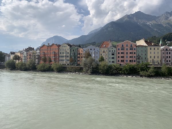
Inn bridge
Opposite Innstraße 5 / Innrain 1
Worth knowing
You could say that the Inn Bridge was the birthplace of Innsbruck. It gave the city its name and for a long time was the only bridge that connected today's old town with the older districts of St. Nikolaus and Mariahilf. The first surviving coat of arms of Innsbruck dates back to 1267 and shows the Inn Bridge on the stone boxes used to secure it at the time. It was also the Inn Bridge that brought prosperity to the city. The Counts of Andechs recognised the importance of the junction between north and south in the movement of goods and had a bridge built over the Inn. Until then, the only bridge over the Inn in this area was the remnant from antiquity at the Roman military camp Teriolis, today's Martinsbühel near Zirl.
Crossing the river on the new bridge had its price for the merchants. At the Inn bridge, customs duties were levied on goods coming into Innsbruck. Not only did the customs duty fill the city coffers, the citizens also enjoyed the passage of the merchants, some of whom had to offer goods for sale in the city that were otherwise difficult to obtain in the Alpine region. Wine, beer, meat, salt, spices, textiles - Innsbruck stood out from the surrounding area thanks to the goods traffic over the Inn Bridge. For the merchants, the bridge was a safer, more reliable and faster way to cross the river.
In 1871, the wooden bridge, which was regularly destroyed by floods, was replaced by an 83 metre long iron truss bridge supported by just two concrete pillars. At that time, Innsbruck had lost its importance as a transhipment centre due to the railway and innovations in transport, but the increasing inner-city traffic made the renovation urgently necessary. The Inn footbridge to the east of the large bridge, which was built to finally replace the ferry journey across the Inn, which was still quite common at the time, was also built in the same year. Until then, rafts carrying goods, mainly timber from the Tyrolean Oberland, travelled along the Inn and docked in St. Nikolaus. The Waltherpark, formerly Innparkin front of the Turnusvereinshaus was built after the raft unloading site was demolished.
The Inn bridge was given its current shape in 1982. The last renovation, including widening, took place in 2023.
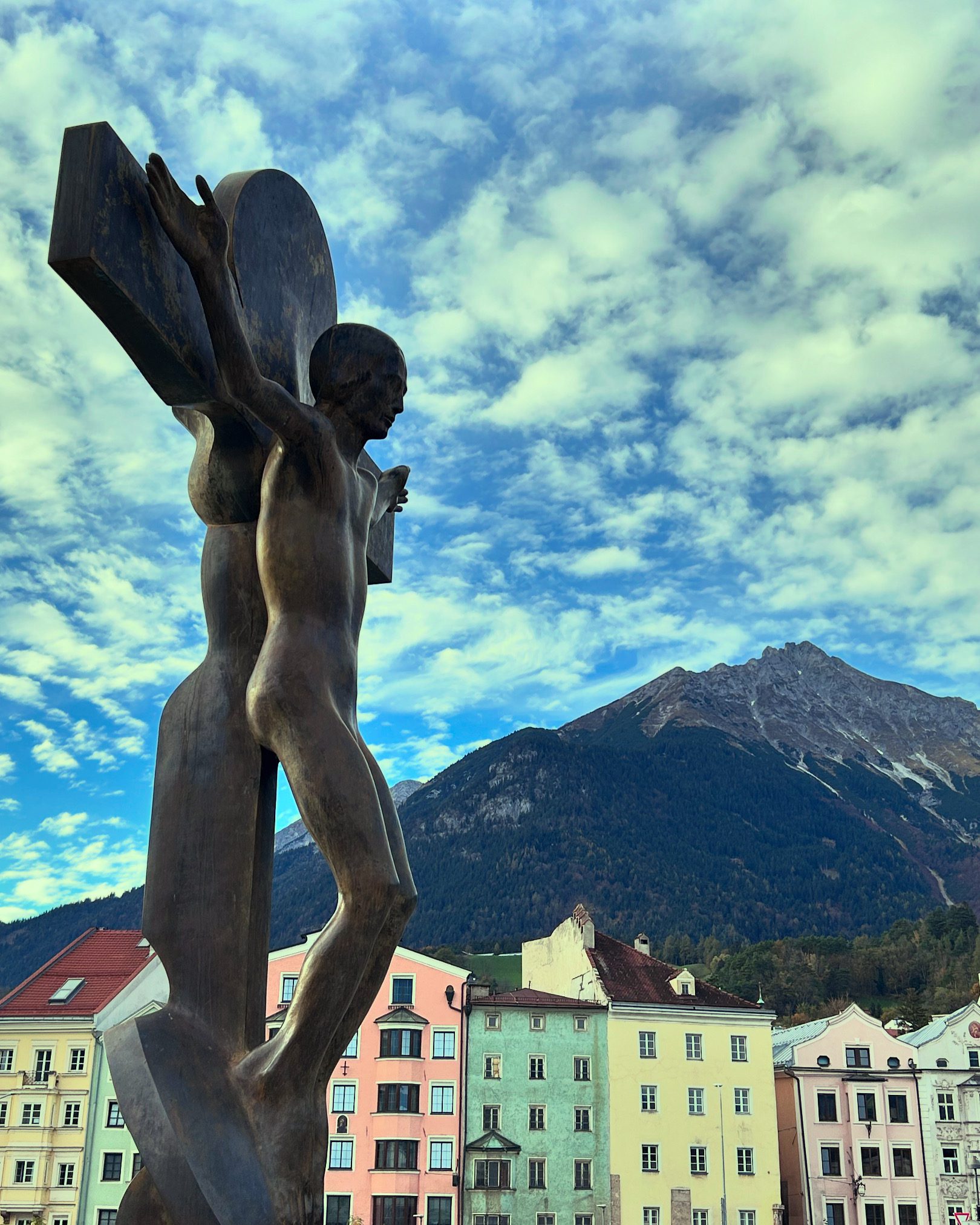
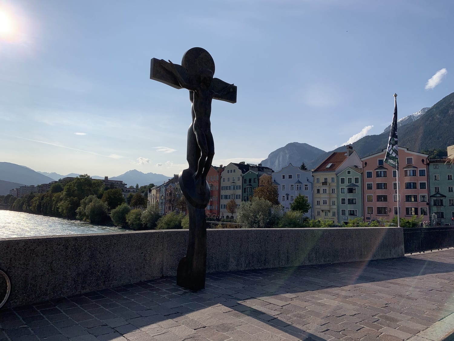
Ein besonderes Schmankerl Innsbrucker Kulturgeschichte befindet sich mittig auf der Innbrücke. Das Kruzifix des Thaurer Künstlers Rudi Wach, das Christus in allzu menschlicher Art und Weise nackt und ohne Wunden zeigt, sollte 1986 aufgestellt werden. Unter dem Druck einer Unterschriftenkampagne besonders frommer Tiroler musste dieses „Skandalwerk“ bis 2007 im Volkskunstmuseum ausharren, bis Innsbrucks erste Bürgermeisterin Hilde Zach es doch noch aufstellen ließ, offiziell um dem Himmlischen für die Verschonung der Stadt vor dem Hochwasser von 2005 zu danken.
The Counts of Andechs and the foundation of Innsbruck
The 12th century brought economic, scientific and social prosperity and is regarded as a kind of early medieval renaissance. Via the Crusades, there was an increased exchange with the cultures of the Middle East, which were more developed in many respects. Arab scholars brought translations of Greek thinkers such as Aristotle to Europe via southern Spain and Italy. Roman law was rediscovered at the first universities south of the Alps. New agricultural knowledge and a favourable climate, which was to last until the middle of the 14th century, made it possible for towns and larger settlements to emerge. One of these settlements was located north of the Wilten monastery between the Inn and the Nordkette mountain range.
After the disappearance of the Western Roman Empire and its administration, various Germanic tribes such as the Ostrogoths and Franks took control of the area that is now Innsbruck. They left ecclesiastical institutions and structures in place to administer the area, as clerics were often the only scribes. A small upper class of armoured aristocrats ruled in a strict hierarchy over the majority of the population, who worked in agriculture in 90%.
In the 6th century, there was increasing Bavarian settlement in the Inn Valley. During the reign of Charlemagne (ca. 748 - 814), the dukes of Bavaria became feudatories of the German kings, whose empire extended over large parts of central Europe and northern Italy. The Breton-Romanised population was displaced after minor conflicts. However, parts of the Christianised culture of the Heiligen Römischen Reichs. Politically, the importance of the North Tyrolean region was mainly limited to the transit sector.
Tyrol had two low Alpine crossings, the Reschen Pass and the Brenner Pass, which were important for the imperial connection between the German lands in the north and the lands in Italy. In 1024, the Salian Conrad II, a rival of the Bavarian dukes from the House of Wittelsbach, was elected king. In order to bring these two Alpine crossings away from his Bavarian rivals and under the control of the imperial church, which was loyal to him, Conrad II granted the territory of Tyrol as a fief to the bishops of Brixen and Trento in 1027. The bishops in turn needed so-called bailiffs to administer these lands and administer justice.
These bailiffs of the Bishop of Brixen were the Counts of Andechs. The Andechs family may be overshadowed today by the Guelphs, Hohenstaufen, Wittelsbach and Habsburg dynasties, but they were an influential family in the High Middle Ages. They came from the area around Lake Ammer in Bavaria and owned estates in Upper Bavaria between the Lech and Isar rivers and east of Munich. Through skilful marriage politics, they had acquired the titles of Dukes of Merania, a region on the Dalmatian coast, and Margraves of Istria. They thus rose in rank within the Heiligen Römischen Reiches on. In the 12th century, they founded the Dießen monastery and the monastery on the holy mountain of Andechs above Lake Ammersee to ensure both administration and later salvation. In 1165, Otto V of Andechs came to the bishop's see in Brixen and gave the bailiwick over this high monastery to his brother. From then on, they administered the central part of the Inn Valley, the Wipp Valley, the Puster Valley and the Eisack Valley.
Today, Innsbruck stretches along both sides of the Inn. In the 12th century, this area was under the influence of two lords of the manor. South of the Inn, Wilten Abbey exercised lordship. The area north of the river was under the administration of the Andechs. While the southern part of the town around the monastery was used for agriculture from an early stage, the alluvial area of the unregulated watercourse could not be cultivated before the High Middle Ages and was sparsely populated.
The Inn Valley was densely wooded and wild. Most of the people at that time worked in agriculture, which was run by their landlord. They lived in poor huts made of mud and wood. There was hardly any medical care outside the towns, infant mortality was high and hardly anyone lived past the age of 50. Around the year 1133, the Andechs founded the market here Anbruggen and connected the northern and southern banks of the Inn via a bridge. The construction of the bridge turned the unusable agricultural land at the foot of the Nordkette mountain range into a trading centre. It greatly facilitated the movement of goods in the Eastern Alps. The Brenner route had become more interesting thanks to one of the innovations of the medieval Renaissance: new harnesses made it possible to negotiate the steep climbs with carts. The shorter Via Raetia had the Via Claudia Augusta over the Reschen Pass as the main transport route across the Alps. The customs revenue generated from trade between the German and Italian towns allowed the settlement to prosper. Blacksmiths, innkeepers and craftsmen settled in the small market.
Anbruggen grew rapidly, but the space between the Nordkette and the Inn was limited. In 1180, Berchtold V of Andechs acquired a piece of land on the south side of the Inn from Wilten Monastery. This was the starting signal for Innsbruck. In the course of building the city wall, the Counts of Andechs had the Andechs Castle and moved their headquarters from Merano to Innsbruck. The new settlement also grew rapidly thanks to the customs revenue.
Sometime between 1187 and 1204, the people of Innsbruck were granted city rights. The official date of foundation is often taken as 1239, when the last count of the Andechs dynasty, Otto VIII, formally confirmed the town charter in a document.
Innsbruck was already the mint of the Andechs at this time and would probably have become the capital of their principality. But things turned out differently. In 1246, the Bavarian Wittelsbach dynasty, the Andechs' biggest rivals in southern Germany, destroyed their ancestral castle on Lake Ammersee. Otto, the last count of the House of Andechs-Merania, died without descendants in 1248. 12 years earlier, he had married Elisabeth, the daughter of Count Albert VIII of Tyrol. This noble family with its ancestral castle in Meran thus took over the fiefs and parts of the possessions, including the town on the Inn, as well as the arch-enemy with the Bavarian Wittelsbachs.
The power of geography
The first thing that strikes every visitor to Innsbruck are the mountains that seem to encircle the city. This mountain world is not only beautiful to look at, but has always influenced many things in the city. It starts with seemingly small things like the weather, as the contemporary view from days gone by proves:
""The warm wind or scirocco is a special phenomenon. It comes from the south, bounces off the northern mountains and falls with force into the valley. It likes to cause headaches, but it melts the winter snow quickly and promotes fertility immensely. This makes it possible to plant maize in Innsbruck""
This weather phenomenon may take its name from Scirocco and traffic was not yet a major problem in 1851. However, just like the Innsbruck car driver today, the blacksmith in the old town in 1450 and the legionnaire sent from central Italy to the Alps in 350 were certainly complaining about the warm downdraught, which seems to drive everyone crazy several times a month. In the past, people were happy about the warm air that melted the snow in the fields, but today, tourism experts moan about the apery ski slopes on the Nordkette.
The location between the Wipptal in the south and the Nordkette mountain range not only influences the frequency of migraines, but also the leisure activities of the people of Innsbruck, as Beda Weber recognised. "The locals are characterised by their cheerfulness and charity, they especially love shore excursions in the beautiful season." One may talk about Kindness and benevolence The Innsbruck locals argue that excursions in the form of hiking, skiing or cycling are still very popular today. No wonder, Innsbruck is surrounded by mountains. You can be in the middle of the forest within a few minutes from anywhere in the city. Young people from all over Europe spend at least part of their time studying at the University of Innsbruck, not only because of the excellent professors and facilities, but also to spend their free time on the slopes, mountain bike routes and hiking trails without having to miss out on urban flair. This is both a blessing and a curse. As a major employer and training centre, the university boosts the economy, while at the same time the cost of living in the city, which cannot grow any further because it is squeezed between the mountains, increases due to students from abroad.
Innsbruck's rise to become the political centre of Tyrol in the 15th century is also largely due to the city's location. The former provincial capital of Merano had no chance against the junction between the Brenner, Scharnitz and Achen Pass due to its remoteness. The Brenner Pass is very low and makes it relatively easy to cross the Alpine belt that winds around Italy's northern border. In the days before the railway brought goods and people effortlessly from A to B, crossing the Alps was hard work and the Brenner Pass was a welcome relief.
The location between Italy and Germany also favoured tourism, which was able to gain a foothold early on. Travellers appreciated the combination of easy accessibility, urban infrastructure and Alpine flair. With the development of the mountainous region by railway, it was easy to travel to and spend leisure time in the mountains or at one of the spas without having to forego the comforts of city life.
Alongside the mountains, the rivers played a key role in Innsbruck's development. Since the time of Maximilian, drinking water was piped into the city from the Nordkette, while the Inn and Sill were responsible for everything else. Washing was done on the Inn, waste was disposed of and cattle were led to the watering place. Goods were shipped on rafts on the Inn from the west to Innsbruck and from Innsbruck to the east. The Inn bridge brought customs revenue into the city coffers. The smaller river that crosses Innsbruck was just as important as the Inn. Where the Sill leaves the Sill Gorge today, the Sill Canal was created at the bottom of Wilten Abbey to supply the city with water. Initially intended primarily for fire protection, the businesses along this man-made canal soon utilised the flowing water to operate mills for power generation. The Small Sill flowed almost 3 kilometres from Wilten to the city centre to the area of today's Ing.-Etzel-Straße in Saggen and Dreiheiligen to the Pradler Bridge, where it rejoined the main river. For almost 700 years, the Sill Canal supplied Innsbruck with water and energy. It was not until the 1970s that the last parts of it disappeared after bombing damaged it during the Second World War.
Last but not least, it is the wide valley basin that favoured the development of Innsbruck. While the farmers in the higher-lying side valleys faced harsh conditions, the Inn Valley offered fertile soil and sufficient land for livestock farming and agriculture. The reclamation of the landscape allowed the town to grow. In the 13th century, as in many parts of Europe, the area around Innsbruck was subject to major and long-term human intervention in nature for economic purposes. Until the High Middle Ages, the Inn Valley had been much more heavily forested. The growth of cities and the rise in population also increased the demand for food. Contrary to what is often portrayed, the Middle Ages were not a primitive time of stagnation, during which people prayed to the Almighty and exposed themselves to the inexplicable forces of nature. It was a dynamic time, especially from the 12th century onwards, when people no longer relied on prayers and God's grace to escape the effects of regular crop failures. Innovations such as three-field farming made it possible to feed the agriculturally unproductive urban population, known in modern parlance as the Overhead would call it. Corn, which Beda Weber considered worthy of mention in Innsbruck's cityscape as early as 1851, is still growing vigorously and even today gives large areas on the outskirts of the city an agricultural flavour.