Saggen & Kohlstatt
Interesting facts about the Saggen and the Kohlstatt
In the second half of the 19th century, Innsbruck expanded in all directions. Comparing maps from 1880 with those from 1930 reveals the growth of Saggen, which to this day is bounded by a bend in the Inn River, the Sill River, and the railway viaduct arches. Wedged between the two rivers, the land’s pointed shape with no exit reminded people of a sack, which led to the name Saggen. As early as 1453, parts of the area were incorporated into the city. In 1495, Maximilian I acquired the section still known today as Kohlstatt and Dreiheiligen to boost weapons production there. Around the arsenal, an early industrial zone developed. In Kohlstatt, coal was produced to fuel the furnaces of the arsenal in Dreiheiligen. Kohlstatt and Dreiheiligen became a working-class district in the 16th century, situated between the city of Innsbruck and rural Pradl. The Sill Canal supplied water to the industrial plants, and the paved Silbergasse connected the manufacturing site to the city. The outskirts served as a dumping ground for everything the bourgeoisie needed but did not want near their homes. Alongside the foul-smelling and dirty factories, the outskirts also housed a hospital—the Siechen- und Brestenhaus. When the early modern weapons factories lost profitability, the military took over Saggen. The increase in standing armies in the 18th century required more space. Where better to house soldiers than in the former workshops of the arsenal in Saggen? In the 18th century, an aristocratic palace next to the Capuchin monastery was converted into a barracks with a drill ground. Today, this area is home to the Fenner complex and the police headquarters.
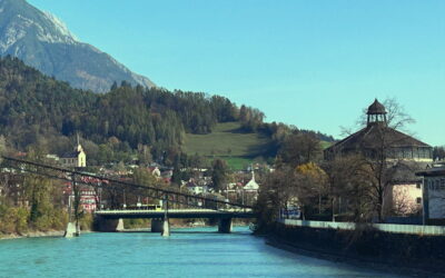
Unlike Kohlstatt and Dreiheiligen, the southwest of Saggen developed differently. Around the meadows east of the Inn, pleasure houses, gardens, and menageries were built in the 16th century. This amusement, hunting, and fishing area of the Tyrolean rulers became the Hofgarten. North of it stretched fields and meadows. In 1581, Ferdinand II built a bridge to connect Hall and Innsbruck via Mühlau exclusively for court members and state guests. In 1643, the Mühlau Bridge was opened for trade as a toll road accessible to the public. The once dead-end sack became a popular entrance to the city, though the name Saggen remained. After repeated destruction of the old wooden bridge by floods, a more stable version was decided upon. In 1843, the Chain Bridge was built. Two tall gate towers rose visibly into the sky, with massive chains spanning 75 meters between them. The Chain Bridge was considered the most expensive of its kind in the entire Habsburg Empire and became a tourist attraction and popular postcard motif.
Zwischen 1830 und 1870 stieg die Einwohnerzahl der Stadt von 12.000 auf 17.000. Studenten, Soldaten und Arbeiter aus allen Teilen des Reiches sowie Zuzüglern auf der Suche nach Arbeit aus dem Umland ließen Innsbruck wachsen. Pradl und Wilten, damals noch eigenständige Gemeinden, wurden von der zweiten Welle der Industrialisierung erfasst. Bäuerliches Leben samt Vieh, das auf den Straßen durch diese Dörfer getrieben wurde, mischte sich mit der neu zugezogenen Arbeiterschaft. Der Saggen hingegen blieb bis in die 1880er fast gänzlich unverbaut, bevor er zum Viertel für gehobenes, bürgerliches Wohnen und Entertainment wurde. In den ersten gut zehn Jahren entstanden vor allem Villen, bevor der Stadtrat die Losung ausgab, östlich der Claudiastraße nur noch Wohnblöcke zu errichten. Am 24. Februar 1900 notierten die Innsbrucker Nachrichten:
„In the eastern urban expansion area at Saggen, an extraordinarily lively building activity seems to be developing this year. Apart from the fact that 9 buildings are under construction in the section for closed construction and four villas in the cottage and will be completed this year, the further construction of 6 houses, including two extensive corner apartment buildings at Claudiaplatz and in Adolf-Pichlerstraße, is in prospect.“
Alongside residential development, modern leisure facilities sprang up between the Chain Bridge and the railway viaducts. The panorama building, the giant circular painting, and the city’s first sports complex with a cycling track, boxing ring, and tennis courts were part of Saggen, as was the Hungerburg funicular, opened shortly after 1900. This infrastructure was no longer initiated by the aristocracy and reserved exclusively for them, as gardens, palaces, and hunting grounds had been in earlier times, but reflected the new social conditions of the late monarchy. Even the palaces of Saggen, the orphanage, and the retirement home in classical style were endowed by the wealthy private citizen Johann von Sieberer, not by the church or nobility. The streets of Saggen were named by a predominantly German-national, educated bourgeois public. Haydn, Bruckner, Schubert, Stifter, Goethe, Schiller, Wagner, and Mozart lent their names to the new streets. These cultural figures were meant to symbolize shared history, culture, and national unity between the German Reich and the Austrian Empire, as well as the power dynamics in the city council under Mayor Greil.
Today, Saggen is perceived by most Innsbruck residents primarily as a venerable upscale district. For the northwestern part between Hofgarten and Messe, where—with very few exceptions—there are hardly any shops or restaurants, the image of a relic from the Belle Époque holds true. Not only in housing but also in healthcare, the district’s offerings stand out from the rest of the city. With the sanatorium of the Sisters of Mercy, an order established in Innsbruck since 1839, a hospital was built next to the Chain Bridge in the second half of the 19th century, erasing the memory of times when plague victims died under miserable conditions in the Siechen- und Brestenhaus. The order’s Innsbruck headquarters is located in the building at Rennweg 40, completed in 1884. The property was purchased in 1847, and the sanatorium still occupies it today. Unlike utilitarian buildings, this hospital was designed in keeping with Saggen’s character, like a palace complete with tower, chapel, and large garden. To this day, those who can afford it flock to this private clinic, while the majority of Innsbruck residents make do with the very good but less aristocratic care at the Innsbruck Clinic.
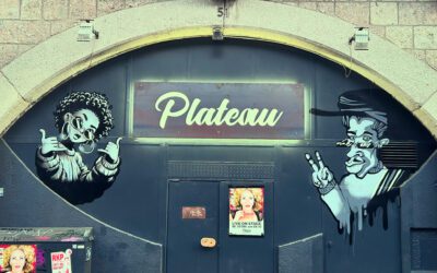
But that is only one face of Saggen. The area around the old industrial and military quarters in Dreiheiligen took a different path. The Block-Saggen contrasts with Villa-Saggen. At the beginning of the 20th century, the municipal slaughterhouse was built at Sillspitz. East of the railway viaduct, the Schlachthofblock became one of the largest workers’ housing complexes in the 1920s. Along the viaduct arches of Ing.-Etzel-Straße and the Messehalle, Innsbruck’s nightlife district has developed over recent decades. While the former working-class neighborhood of Wilten is now mainly home to students in shared apartments, this part of Saggen has become the quarter of car mechanics, barflies, and hipsters.
Villensaggen
Falkstrasse / Saggen
Viaduct arches
Ing.-Etzel-Straße
Slaughterhouse block
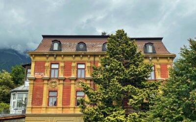
Erzherzog-Eugen-Straße 25 - 38
Palais Ferrari & Old Garrison Hospital
Weinhartstrasse 2 - 4
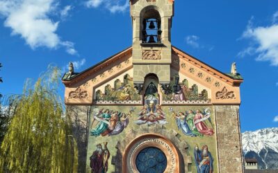
Lutheran Church of Jesus Christ
Richard-Wagner-Strasse 2
Monastery of Perpetual Adoration
Karl-Kapferer-Straße 7-11
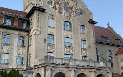
Collegium Canisianum
Tschurtschenthalerstrasse 7
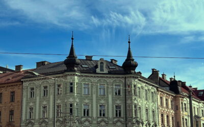
Claudiaplatz
Claudiaplatz
Panoramagebäude
Rennweg 39
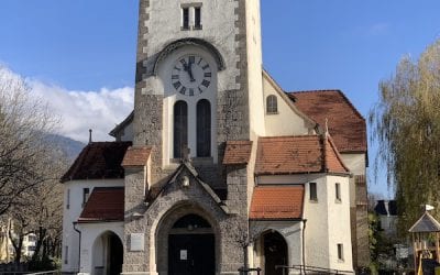
Church of the Holy Trinity
Dreiheiligenstraße 10
Kaiser-Franz-Joseph-Greisenasyl
Ingenieur-Etzel-Straße 59
ÖBB Administrative Building
Claudiastrasse 2
Orphanage - Siebererschule
Siebererstraße 7-9
Armoury
Zeughausgasse 1
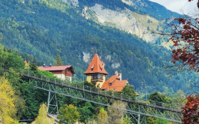
Hungerburgbahn & Nordkettenbahn
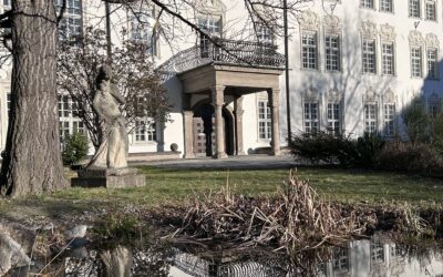
Congress Centre / Rennweg 39